
"GROUND PENETRATING RADAR IMAGING SOFTWARE"
This product developed by the Geophysical Archaeometry Laboratory has become the most popular software for GPR data processing. But why?
Because GPR-Slice was particularly programmed to cover the needs of the GPR surveyor. Most of the other software packages available in the market come from universities, research labs or GPR manufacturers. GPR-Slice unites years of experience in the field, feedback from thousands of users across different continents and practices together with theoretical knowledge of PhD geophysicists and engineers. Finally, years of interaction with some of the major manufactures. This makes the software flexible and adaptable to different applications, research needs and GPR systems.
This work philosophy of continuous interaction between users and developers drives the development of this growing software platform.
For the complete list of subscribers, please visit: https://www.gpr-survey.com/subscriber-list.html
Some of GPR-Slice unique functionalities are:
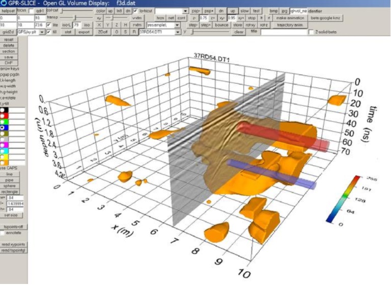
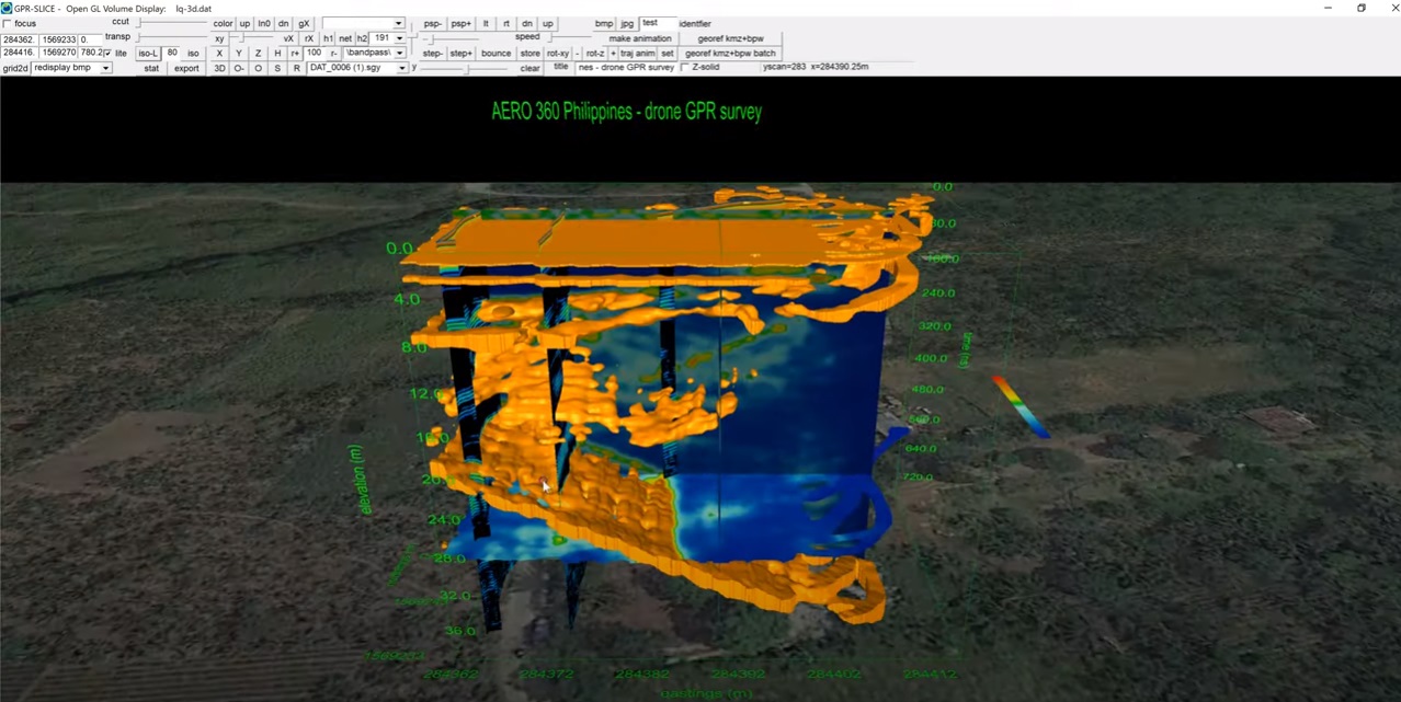
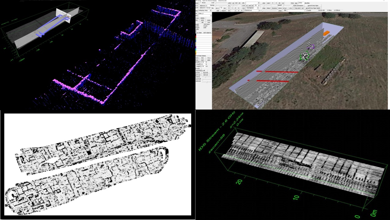
The first thing that you notice using GPR-Slice is the ability to create comprehensive images from the same data that within other software look blurry or pixelated and basically unpresentable. In fact, during our workshops there is always that wow moment when data are displayed in OpenGL. This 3D viewer menu provides great user experience and allows producing high quality imaging and animations to include on reports and presentations.
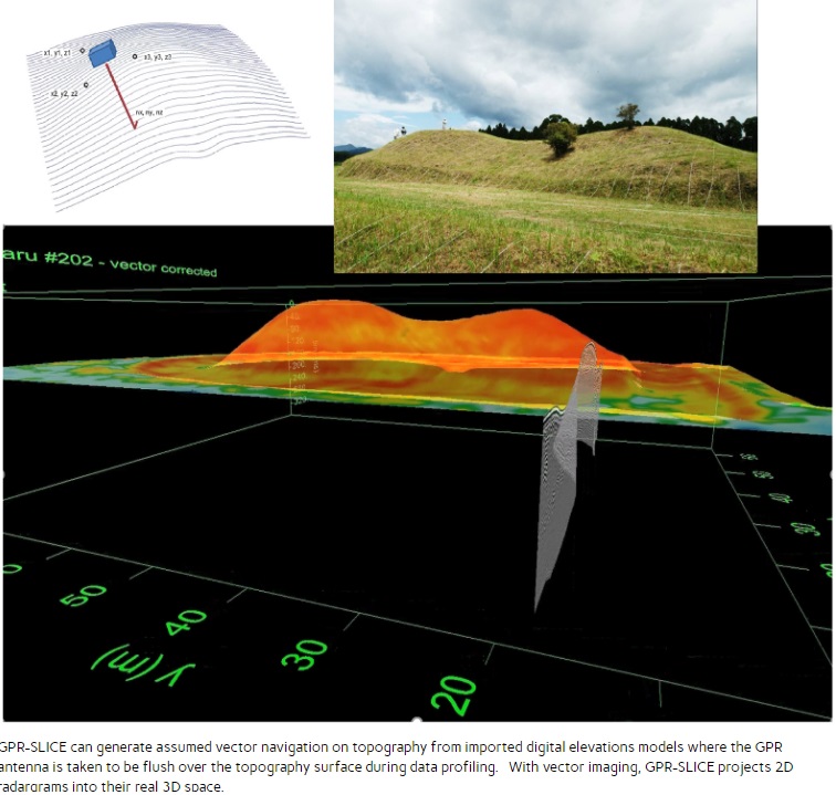
In many occasions, the terrain surface to survey is uneven. The steeper the slopes, the more will affect data interpretation. A Static-Topography menu is available to make topo (or topo+tilt) corrected radargrams and volumes. The representation of data will not be just flat but could be warped to the digital terrain model.
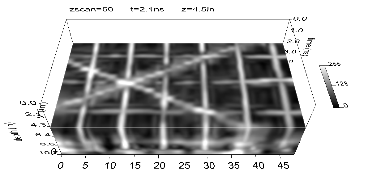
How many times did you have to explain what a hyperbola in the data means to justify your results and data interpretation? Well, perhaps we will never get rid of that completely. But in certain cases, this 3D imaging technique can provide a much more intuitive image to explain.
This is one of the most important functionalities as it generates a comprehensive image of reflections at different depth levels. In cases when continuous features are at varying depths in the ground, the overlay analysis will help to create a useful map containing all the relevant objects on a single image. Particularly useful tool for applications like archaeology, utility mapping and concrete scanning (as seen in the following image with post-tension cables and different levels of rebars).
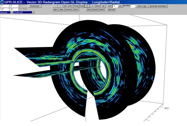
Let’s say we need to do a survey in a tunnel or columns, how would you like the data to be visualized? All traditional software packages would show them flat without accounting for the shape of the scanned object. GPR-Slice is equipped to handle complete random antenna navigation in 3D space considering both the xyz location as well as the antenna orientation (roll, pitch and yaw).
The software provides many more functionalities: BlueBox batch process; Multichannel data processing module; Horizon detection and mapping; Bridgedeck evaluation maps; Staggering and mosaic corrections; 3D filtering including migration and similarity; GNSS/TS data integration… And many more tools within the most complete GPR data processing software package in the market. If you want to be at the forefront of this technology, subscribe to GPR-Slice!
GPRSIM - Ground Penetrating Radar Simulation - is a forward modeling interactive software package for Windows that is designed specifically for simulating radargrams collected with a ground penetrating radar instrument. Since the user specifies many instrument design features in the software, radargrams collected from a variety of commercially available systems can be easily simulated.
The main GPRSIM functionalities are:
GPRSIM predicts the waveform of microwaves that are reflected, transmitted, refracted and attenuated across model ground structures. (The complete theoretical details of GPRSIM are published in Geophysics, Goodman D., vol 59-2, p224-232, 1994).
GPRSIM uses advanced 2D ray tracing, which is enhanced to include antenna aperture sizes, antenna design with receiver/transmitter directional responses, mono-static, bi-static simulations, vertical profiling, wide angle, expanding spreads... Therefore, radargrams collected from a variety of commercially available systems can be easily simulated.
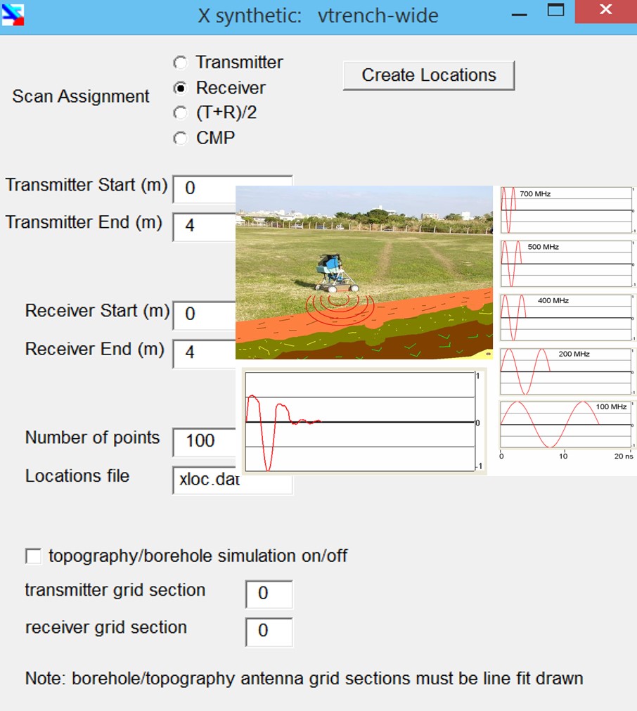
A comprehensive model drawing menu is provided to input almost any kind of subsurface structure that a user can imagine, using lines, splines, and special functions (e.g. cylinders for pipe simulations). Included is a materials submenu where the user can set the complex dielectrics and conductivities for the designed structure in addition to assigning material identifier names.
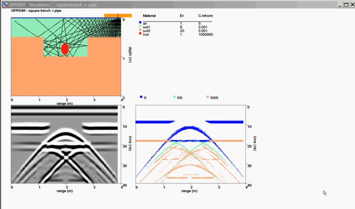
The essential feature of GPRSIM software is that it is a raytracing algorithm. True amplitudes from reflected returns of subsurface structures can be closely estimated by sending many kinds of waves with various traveling itineraries into the model. The travel paths referred to as raypaths or wavetypes are specified according to the orientation and shape of interfaces in the model. Some wavetype examples are:

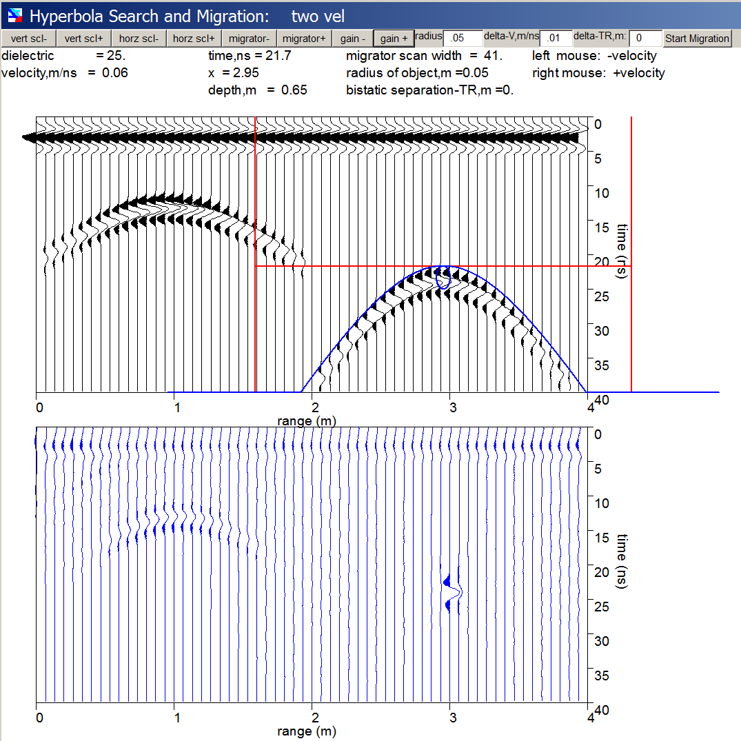
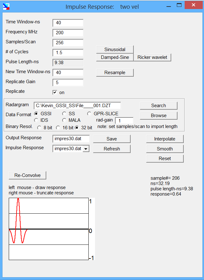
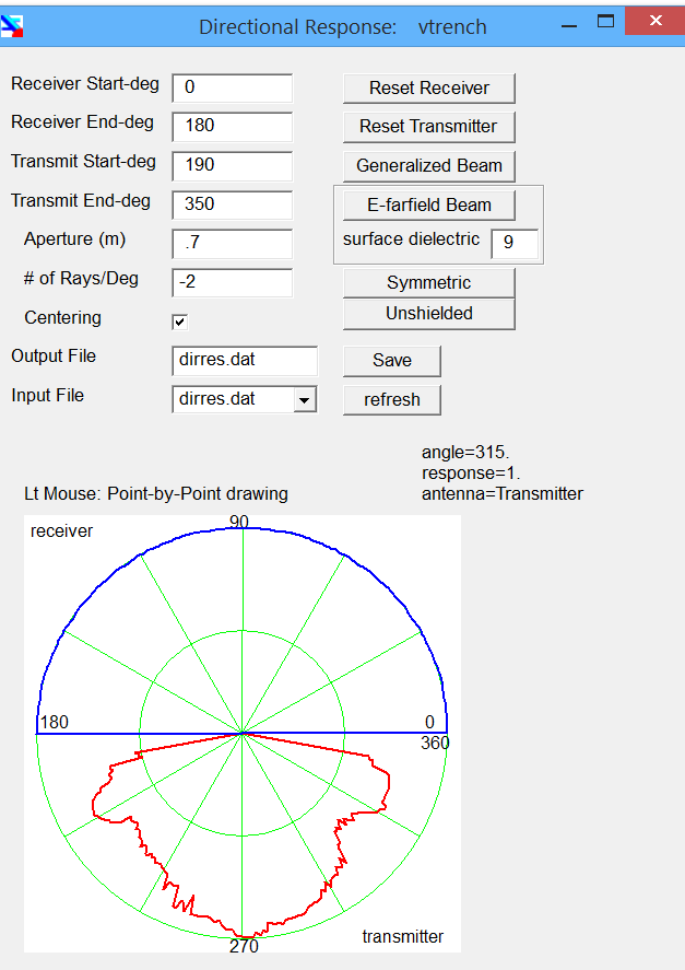
The PULSE menu can be used to (1) cut an impulse response function from a real radargram file, (2) create a sinusoidal or damped sine response, (3) draw or edit an impulse response function, or (4) resample a response function. GPRSIM can include real impulse response functions that can be chosen from real radargrams.
The BEAM menu can be used to (1) draw or edit an antenna directional response for either the transmitter or receiver, (2) constrict or enlarge the antenna beams, (3) set the digitization or resampling of the beam, (4) set the antenna aperture size, and also (5) to set a centering switch which will describe what part of the (receiving) antenna surface the ray tracing will be calculated to.
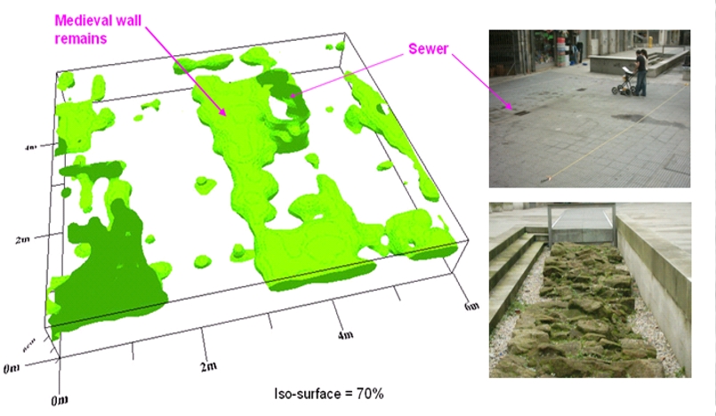
GPR-Slice became a full commercial product in 1994. But its impact began years before when pioneer Dean Goodman was carrying out large GPR survey campaigns over Kofun burial mounds in Japan. His novel way of processing and visualizing GPR data by introducing revolutionary techniques (like overlay analysis, depth-slice animations, isosurfaces and volumes) marked a milestone in GPR archaeological prospection.
His first publications during the 90s together with the software commercialization set the foundations for many researchers and service providers to numerous prospections, scientific articles and workshops that helped spreading the knowledge about GPR technology in different fields of application. From very specific ones, like utility mapping and concrete scanning, to broader subjects in geophysics, civil engineering, architecture or agriculture. All this accumulated knowledge and experience are included in GPR-Slice.
Here we show a small sample of success cases. However, there are many more examples on the internet (see the Contact section for some useful resources).
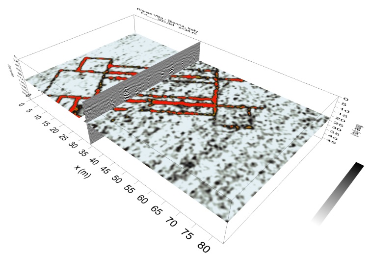
This image shows, in red color, the buried foundations (at 1m depth) of a Roman villa in Grosseto (Italy). During this survey I met Dr. Dean Goodman (GPR-Slice founder and developer). Dean was one of the lecturers at the XV International Summer School organized by the University of Siena in 2006. The attendees were learning theoretical and practical concepts of different geophysical methods. I remember pushing that old GPR system under a burning sun. In between profiles, we tried to find a hyperbola on the screen that gave us the motivation to keep surveying. The following day, during the data processing lecture, Dean showed us how to create this image and reveal the Roman walls that were invisible the day before in the field. Fortunately, I was able to convince my supervisor that we needed to subscribe to the software in order to finish my PhD thesis. And that is how all began!
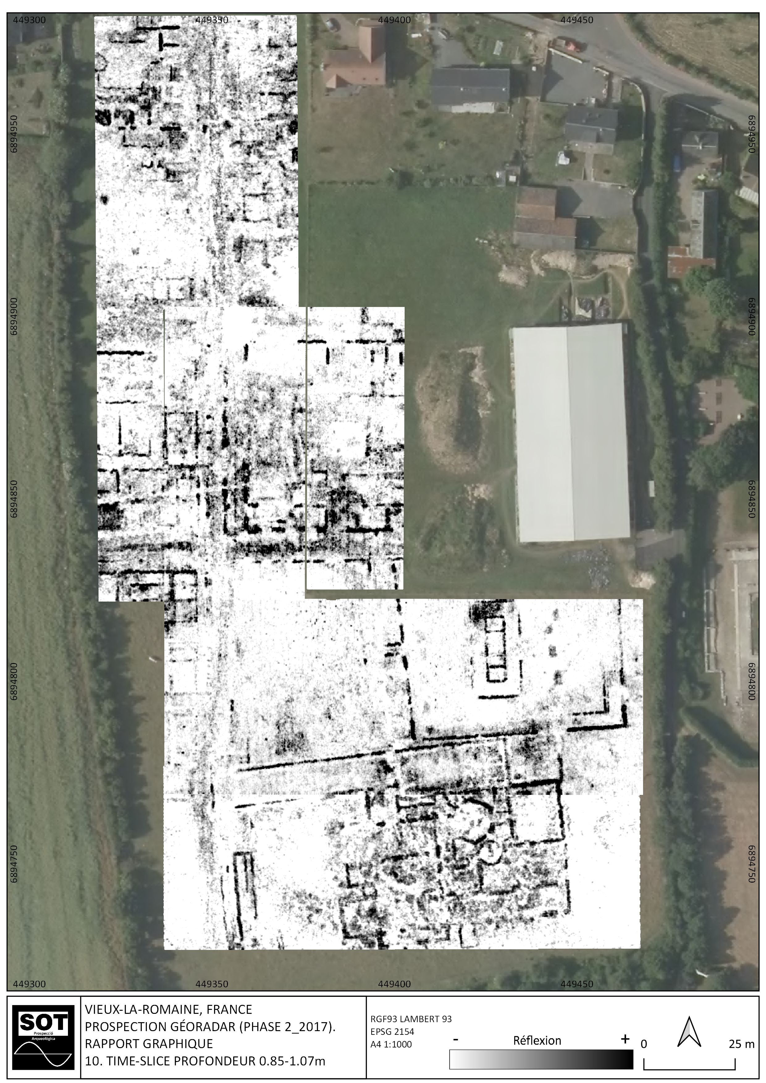
SOT Prospection was one of the early adopters of GPR-Slice in Europe, and particularly, the pioneer in Spain. Subscriber since 2004, SOT accumulates a vast experience on archaeological mapping and civil engineering applications with GPR and other geophysical techniques. You can discover their spectacular work in archaeological sites through their channels, publications and workshops. As an example, this fabulous slice (at 1m depth) depicting with extraordinary detail the remains of the Vieux-La-Romaine site in France.
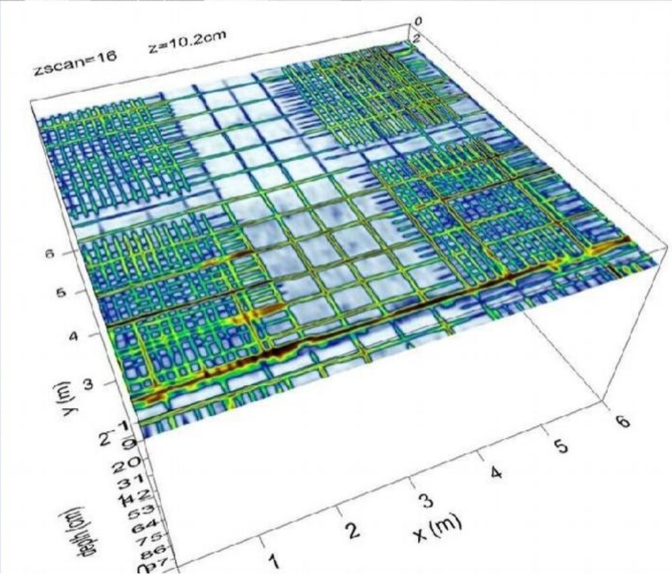
Allegedly, the two most popular GPR applications are in concrete and utilities either for real-time detection (of pipes, conduits, rebars, cables, etc.) or for more detailed asset mapping and as part of subsurface utility engineering processes. This has propelled the number of GPR services companies but also increased the amount of GPR manufacturers over the last 10 years. GPR-Slice provides functionalities, like xy decouple gridding, specifically designed for concrete mapping. As well, GPR-Slice OpenGL modules include menus to draw utilities and rebars on top of slices while viewing X and Y radargrams simultaneously. Then, results can be exported to .dxf and .kml formats. Another unique tool, called overlay analysis, is extremely useful to enhance visualization of different rebars levels, conduits and cables and represent them all in one single image. Qualitative maps (moisture content) for bridge deck evaluation are also available.
In 2010, during a project in St. Croix, Dean and I were debating about the possibility of including a new software module dedicated to the novel (at that time) multichannel (MCGPR) systems. We decided to go ahead with it and in the following ten years 40% of the total number of licenses included the multichannel module. MCGPR systems have revolutionized this technology by dramatically speeding up high-density sampling data acquisition. This makes data interpretation easier due to full-resolution imaging, but it also allows surveying of very large areas (>10has.), which are unapproachable with single channel GPR systems. Most importantly, more people can understand these MCGPR full-resolution images without prior understanding of GPR fundamentals. And this has been a big leap!